
Walking a Houston Street Directory by Address
A by-address search works best as a chain of records. Confirm the postal form first, then use the exact location in HCAD Property Search. The appraisal card supplies the account number, situs address, legal description, owner and tax mailing address. The last two can differ. That difference matters because a tax notice destination is an associated record field, not proof that its recipient lives at the parcel. Use the account and legal description to keep each result tied to the same Houston place.
- Check the delivery form with the USPS ZIP Code Lookup, then search HCAD by property address.
- Save the parcel account and legal description. Open the HCAD Parcel Viewer to see the selected parcel beside nearby polygons.
- Use the legal description and the current owner as grantee in the Harris County Clerk real-property index.
- Read the instrument, then use the seller as an earlier grantee when tracing a transfer backward. Compare the legal description each time.
- For a historical address lead, consult criss-cross directories at Clayton or Houston Public Library. Use a voter lookup only to check a particular person’s registration context, not to create a street roster.
The sequence is address, parcel, owner, legal description, recorded transfer, then historical context. It is deliberately narrower than a broad name search. If the question changes from a street to one person, the Houston resident lookup has a different verification route.
Houston Street Directory Parcel Routes
HCAD makes the quickest current bridge from a Houston address to a property record. Its online public appraisal data is 2009-current, and it offers three starting routes. An account number is best when already known. A property-address search uses the situs location. An owner-name search can uncover an associated parcel, but the result remains a tax and appraisal record rather than a deed. Earlier appraisal material follows an offline route through HCAD.
| HCAD control | How it narrows a Houston street search |
|---|---|
| Account number | Direct route to a known parcel account. |
| Property address | Searches the situs address; use number, street name, suffix, and direction carefully. |
| Owner name | Finds parcels associated with an owner name; test surname and initial variations. |
| Map click | Selects a parcel polygon in the GIS viewer and links to parcel information. |
| Address or account in viewer | Opens map context without assuming a polygon is a legal survey. |
Parcel cards can show an account, owner, property location, mailing address, legal description, neighborhood label, land and building details, values, exemptions, sales, a sketch, and sometimes ownership-history clues. Preserve the account number and legal description before moving to another system. A by-address search is stronger when those keys match across records.
The Harris County Tax Office property screen gives a second official route by account, name, or address, with a related receipt search. Its online data is current only as of the statement or receipt date. The county cautions that a record may be absent while certification, an ownership change, a review, or an opt-out block is being handled. A blank response is not proof that the parcel or its history is absent. For an official account question, use the Tax Office phone or in-person channel.
Houston Street Parcel Maps
The parcel viewer supports a practical walk along a block: select the first parcel, click the next polygon, note each account, and open the linked appraisal card. HCAD describes the boundaries as approximate and informational rather than a survey. The public ArcGIS layer also has a 1,000-record maximum response, so a whole-city query is not a substitute for a careful street-by-street review.
See the HCAD parcels service used for the mapped layer.
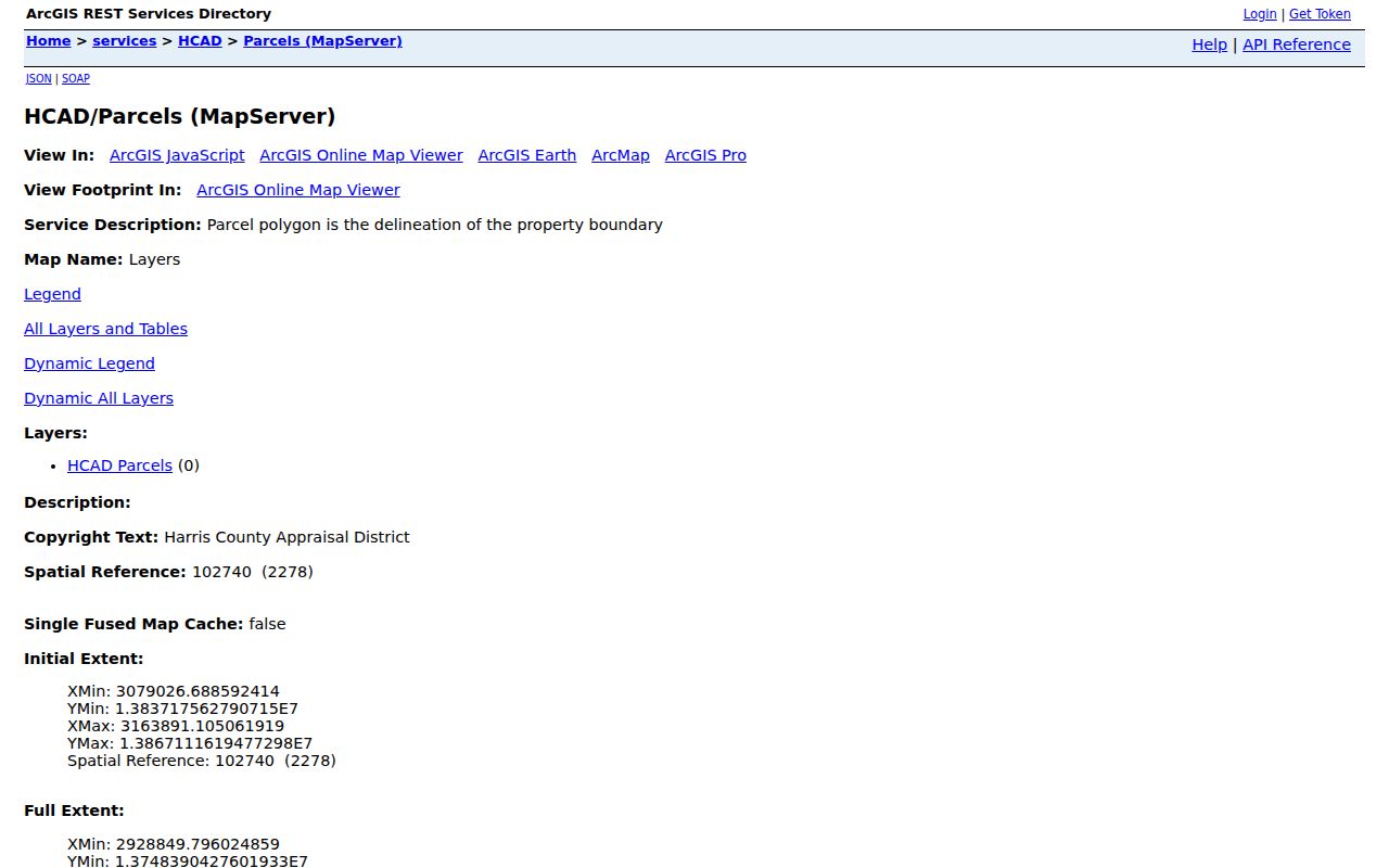
The service view illustrates why a mapped parcel is only the geographic starting point. A road, alley, drainage tract, or narrow parcel can make apparent proximity different from an actual adjoining boundary.
Houston Street Deed Parties
The Harris County Clerk real-property search is organized around names and legal descriptions, not a complete modern street-address chain. Online images generally begin around November 1, 1960, while county land records extend from 1836 to the present through office, archive, and microfilm channels. Search the current owner as grantee, select entries that match the subdivision, lot, block, abstract, tract, reserve, or unit, and inspect the image before treating it as part of the same parcel history.
The backward method is useful when an address changed names or sits in an older subdivision. The seller on a purchase deed becomes the next earlier grantee. Repeat that search within a plausible date range and record the file number, date, instrument type, all parties, and legal description. A release, lien, deed of trust, restriction, or correction may affect the property without recording a change of ownership.
The County Clerk distinguishes a free watermarked online image from an ordered copy. Its published information lists noncertified paper copies at $1 per page, electronic copies at $1 for up to ten pages and $0.10 per page after that, and an additional $5 for certification. Documents before January 2000 can require an office search or request depending on availability. For material before the web range, use County Clerk warehouse books, the central microfilm terminal, Harris County Archives, Texas State Library and Archives Commission microfilm, or a records request.
Search tip. Follow the legal description and prior grantee, not a street name alone, when an older Houston deed index does not recognize the modern address.
Houston Street Records at an Address
Several Houston and Harris County systems attach useful facts to an address, yet their purposes differ. The table separates ownership and place history from evidence about a particular registered voter or a past directory occupant. Start with the record that matches the question, then move to the custodian’s alternative access channel if the online result is missing.
| Address record | Houston-area custodian | Useful street detail | Access path |
|---|---|---|---|
| HCAD parcel card | Harris Central Appraisal District | Account, owner, situs, mailing address, legal description, values, exemptions, and sales. | Online search; pre-2009 appraisal records go to HCAD. |
| Parcel map | HCAD GIS | Parcel polygon, location, nearby parcels, and account link. | Map viewer; boundaries are approximate. |
| Tax statement | Harris County Tax Office | Account and address or name search, billing and receipt context. | Online property search; confirm official questions by phone or office. |
| Recorded instrument | Harris County Clerk | Grantor, grantee, date, type, legal description, and image when available. | Online index plus the Clerk counter, warehouse books, archives, microfilm, or a request for older material. |
| Permit or 311 case | City of Houston | Work or service history tied to a job address or case number. | Permit portals and Houston 311; seek a complete permit file through the Texas PIA route. |
A parcel account links the appraisal and tax systems. The legal description links the appraisal card to a deed. A street name helps find the parcel and historical directories, but it can change over time. The Texas My Voter Portal is a separate person-specific route, not a public list of everyone on a street.
Houston Street Permit History
Address-keyed permit records add place history, not a complete resident list. The current Houston permit portal describes real-time searching, status checks, payments, printing, and inspection requests. Its entries can contain public applicant, buyer, or owner fields when those fields are exposed. A name on a permit does not automatically establish that the person lived at the site.
For earlier basic permit history, the city’s sold-permit search accepts date ranges, project number, buyer’s name, ZIP, job address, buyer’s address, applicant name, permit type, building use, and related categories. The online history is limited to the prior three years. A complete chronology requires a city records request that identifies the address, approximate years, and requested document types.
View the current Houston permit-search portal before choosing a record type.
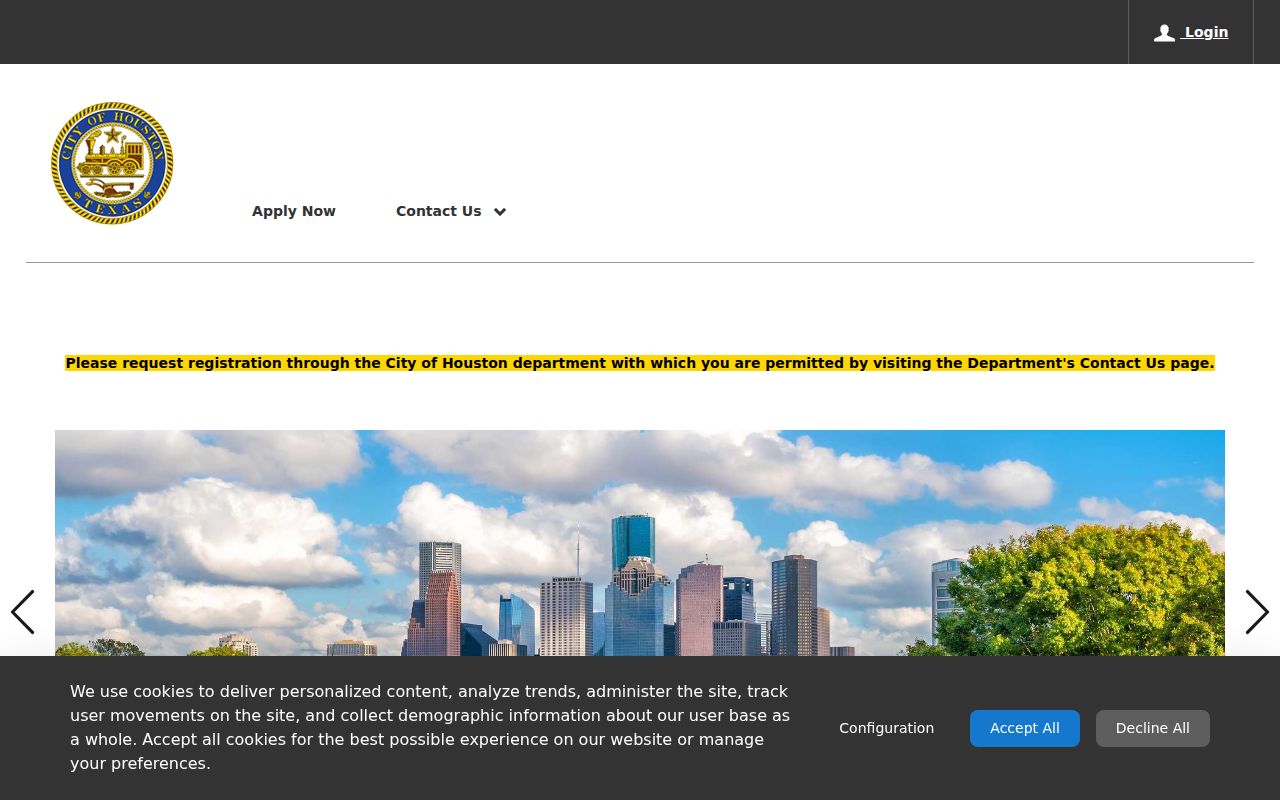
The portal is a useful starting point for recent work at a location, while a records request remains the documented fallback for a full address history.
The older sold-permit form shows how an address or ZIP can narrow an older search.
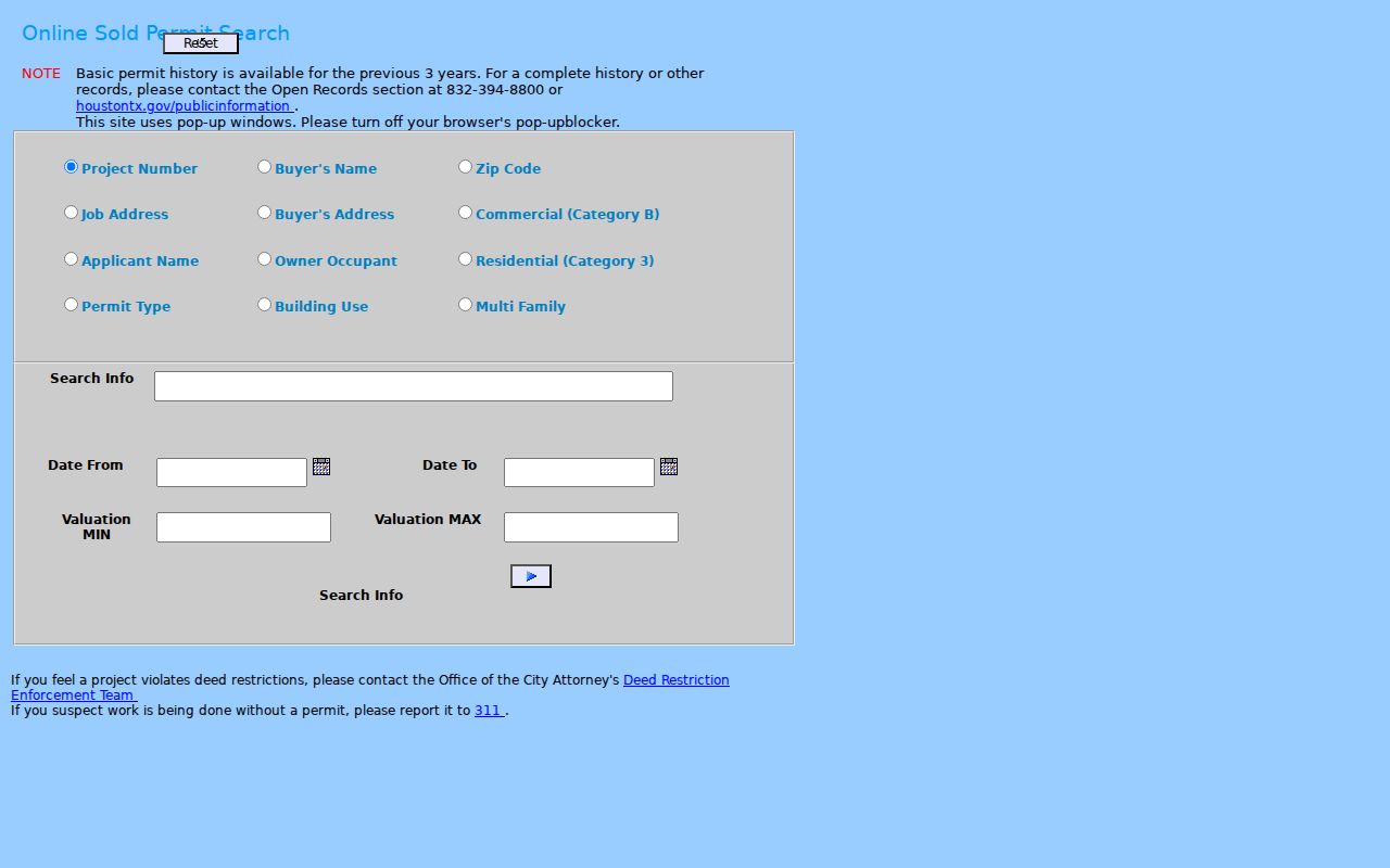
Its field choices make a permit useful for dating work at a site, but not for identifying an entire household.
Houston Streets Across Time
Houston is not one uniform grid. The Heights system uses Heights Boulevard as a spine, named north-south streets, numbered east-west streets, and East or West designations. Other areas carry subdivision, annexation, directory, and postal clues. Planning and Development assigns official city addresses and confirms annexation boundaries, while a postal Houston label can also apply outside the incorporated city.
The official annexation history map spans 1836-2023. Houston renamed Dowling Street to Emancipation Avenue in 2017, a clear reminder to search both current and historic labels. When a by-address search returns nothing, try the former name, subdivision, legal description, plat, Sanborn map, or old street guide. No complete official citywide number-change crosswalk was found.
Houston Street Directory Criss-Cross Clues
Criss-cross directories reverse the usual name-first arrangement. Start with an address and read the listed occupant or owner entry. Houston preservation sources describe runs from 1925 to the present, although exact title and year gaps vary. The stronger historical shelf is at Clayton Library Family History Research Center, which also holds directories, newspapers, yearbooks, funeral-home records, and maps.
These are historical leads, not a current-residency substitute. Houston’s digital city-directory series begins in 1866, and physical holdings continue through 1986. For collection details and a household timeline, use the Houston city directories resource.
Clayton’s documented reference service can accept a narrow address question: one address in five-year steps, or two addresses in two- to three-year steps, subject to a five-request monthly limit. The library asks researchers to use its stated email route for that service rather than requesting broad research by phone. Pair a directory lead with a deed, census schedule, Sanborn map, newspaper, or probate source when the goal is to understand a past household rather than merely to read a name beside an address.
- Parcel
- A mapped unit of property tied to an account and legal description.
- Situs address
- The physical property location, distinct from a mailing address for tax notices.
- Plat
- A recorded map that lays out lots, blocks, streets, or subdivisions.
- Criss-cross directory
- An address-first directory that can point to a listed past occupant or owner.
Houston Street Record Gaps
An online gap is often an access problem rather than proof that an address trail ended. HCAD’s public online data begins in 2009, and online real-property images generally begin around November 1, 1960. Harris County land records extend far earlier, but their path changes to the County Clerk office, historical warehouse books, central microfilm terminal, Harris County Archives, Texas State Library and Archives Commission reels, or a written request.
TSLAC lists Harris County deed records for 1837-1886 with direct and reverse indexes. Its holdings also document that some probate and court volumes have missing pages or reels. Record the volume, reel, and search terms used before changing repositories. A subdivision, lot and block, abstract, tract, or older street guide can supply the bridge when a present-day by-address search does not return a direct match.
Limits of a Houston Street Directory
An address record is not a complete household record. HCAD can name a parcel owner and show a mailing address, but it does not establish who currently occupies the property. A deed identifies parties to an instrument, not necessarily the people who lived there. Houston permit and 311 records may place a public event at an address, but they are not proof of residence. The public voter route can check one person’s registration context, and it is not a free block roster.
Texas protects driver-license numbers, Social Security numbers, and other voter identifiers. Eligible people may also use the Texas Address Confidentiality Program or statutory address protections. Utility-customer data and household membership are not a general public street list. Missing material should lead back to the proper custodian, the archive, or a Texas Public Information Act request for existing records, not to an assumption about a person.
Lawful use. Use Houston address records for family history, estate research, civic questions, or correcting a record. Texas law prohibits stalking and harassment; do not use a record to pressure, follow, or harm anyone.