
Houston ZIP Service Areas
The City of Houston publishes a city-service ZIP reference set and map PDFs. The entries below are selected examples from that official list. They identify useful geographic context, not a guarantee that a ZIP lies entirely within city limits or that every delivery address uses the same postal city. The city ZIP page does not supply a station-by-station post-office directory, current population counts, or a current split history, so USPS remains the delivery check.
| ZIP | City-service area | Postal note | Research caution |
|---|---|---|---|
| 77002 | Downtown and central Houston | Houston postal city | Station assignment is not specified on the city ZIP page. |
| 77008 | Heights and north-central Houston | Houston postal city | Verify delivery details with USPS. |
| 77030 | Texas Medical Center | Houston postal city | Postal city is not municipal-boundary proof. |
| 77077 | West Houston and Energy Corridor | Houston postal city | Verify the specific address and recognized city name. |
| 77099 | Southwest Houston and Alief side | Houston postal city | The city map shows a ZIP and city-limit mismatch here. |
| 77339 | Kingwood-area reference | Postal city varies | Not wholly Houston city; USPS confirmation is required. |
| 77489 | Missouri City-area reference | Postal city varies | Not wholly Houston city; USPS confirmation is required. |
A full Houston postal reference should begin with the City of Houston ZIP maps, then validate the specific address with USPS. Nearby references include Kingwood, Humble, Sugar Land, Missouri City, Friendswood, and Webster areas, which is why a postal label alone cannot settle a municipal question.
Houston’s address authority is Planning and Development’s GIS division. It assigns city addresses, maintains geographic data, coordinates emergency providers, and confirms annexation boundaries. USPS standards also shape street suffixes and delivery forms. A large parcel can receive more than one number, while odd and even numbers generally increase on opposite sides of a street subject to local patterns. Those rules explain why a postal result, city address, and appraisal record should be compared rather than collapsed into one field.
Houston ZIP Delivery Checks
USPS offers three distinct checks: validate a full address, return recognized ZIPs for a city and state, or show associated city names for a known ZIP. This matters in Houston because the physical address, postal address, parcel account, and legal description are separate keys. If the service returns more than one delivery match, add the apartment or suite before copying a ZIP into a local record search.
| USPS mode or field | Use for a Houston ZIP check |
|---|---|
| Street Address | Required main delivery address in the address route. |
| Apt/Suite | Optional unit detail that narrows multiple matches. |
| City and State | Required city and state fields for an address lookup or city-state route. |
| ZIP | Optional narrowing for an address lookup; required for the cities-by-ZIP route. |
| Company or Urbanization Code | Optional fields when relevant to the delivery address. |
The USPS ZIP Code Lookup expressly does not confirm that a person or company is at an address. It verifies delivery information. That distinction is central to a careful Houston postal search.
Save the USPS result beside the property’s situs address and legal description instead of replacing those fields. HCAD uses the situs and account key, while a deed relies on the legal description. The Harris County voter route has a registration-address field and protected-field rules. A matching ZIP can help select the next search form, but the underlying record must still be matched to the same person or parcel.
Finding Houston Records by ZIP
A ZIP narrows geography, not identity. Start by verifying the delivery form, then use a complete address or a known name in the custodian system. The Harris County voter portal includes ZIP as a narrowing field in its personal-information route. The Tax Office can search a property statement or receipt by account, name, or address. A tax-sale listing includes address and ZIP data, but it is a changing tax-sale record rather than a resident directory.
- Run the address through USPS and retain the street number, recognized city name, unit, and ZIP together.
- Use the verified address in HCAD Property Search to reach the parcel, account number, situs, legal description, and owner fields.
- Use the Harris County voter portal only for a particular person’s registration context. ZIP is a field, not a route to a public area roster.
- When a known property is narrowed to a street, continue with the Houston street directory workflow for parcel and deed records.
The statewide voter-file request is a different process. It asks for a county or statewide scope, active or suspense status, delivery details, and an affidavit under Texas election rules. It is not the same as a consumer-facing ZIP result and it carries use restrictions.
HCAD’s public online appraisal data begins in 2009. Its property card can show a situs location, mailing address, legal description, owner, values, exemptions, and a sketch, but it is not a deed. For a Houston location with older appraisal history, Harris County Records Management directs researchers to HCAD instead of the public online screen. The county parcel viewer can then place the selected account on the map, although its boundaries are approximate and not a survey.
Houston ZIP Record Tools
Official and state tools treat ZIP as one filter among several. The Harris County Tax Office statement screen searches by account, name, or address, with a separate receipt search. Its results can help confirm tax-account context once a full address is known. The tax-sale listing records address, ZIP, account, cause number, minimum bid, adjudged value, and precinct data, and the county warns that it changes daily.
Use the Harris County Tax Office property search for the account, name, or address route shown on its statement screen.
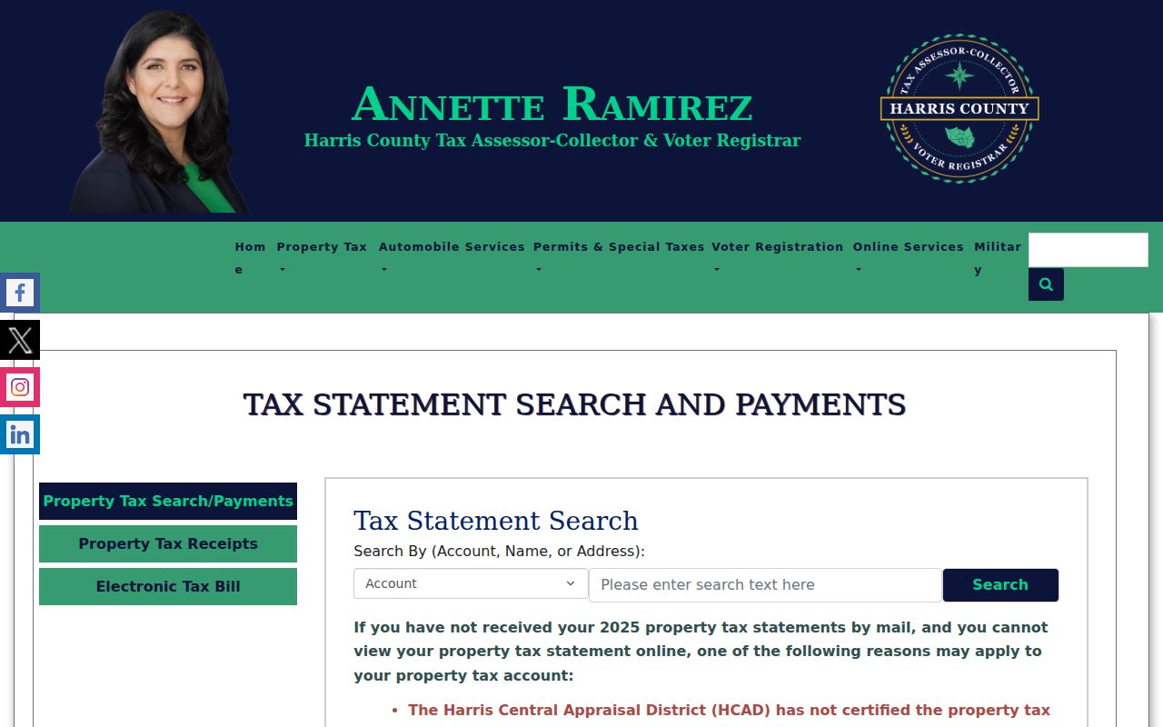
The screen is useful after an address is known. It does not turn a ZIP into a list of people in that postal area.
The official Harris County tax-sale listing exposes ZIP and address information as part of a changing property record.
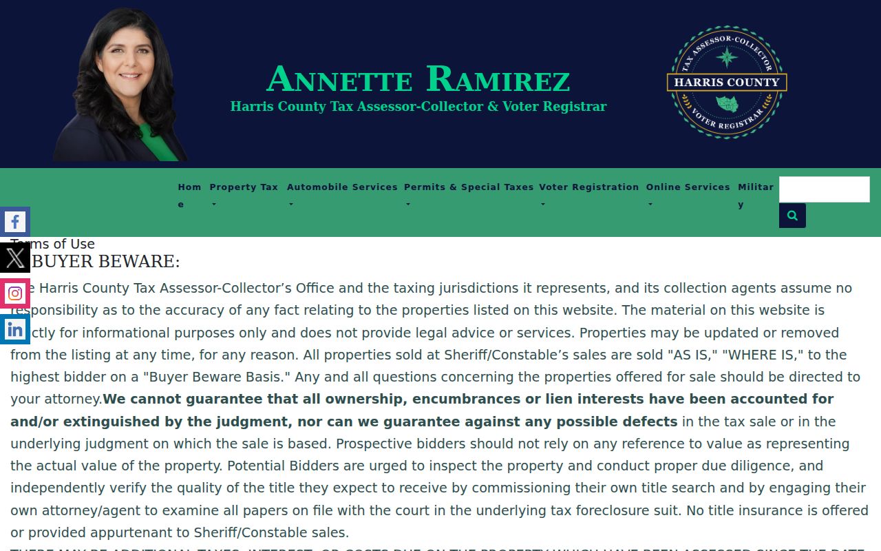
Use it for the displayed property context only, then confirm a current account question with the county by phone or office.
For a local street or lot question, the Tax Office block-book resources add subdivision, survey, block, lot, and map-file context. The block-book database contains more than 16,280 subdivisions and surveys. That scale is one reason a ZIP alone is too broad for a parcel conclusion. Move from ZIP to the full address, then to the account and legal description before comparing any recorded instrument.
Houston ZIP Professional Filters
Some Texas professional searches accept a city, county, or ZIP, but they answer a separate question from a resident search. The Texas Department of Licensing and Regulation Active License Search accepts license type, number, expiration date, individual or business name, city, county, and ZIP. TexasOnline Professional Profiling asks for profession, name, city, state, and ZIP, and warns that much of its information is self-reported.
Check the Texas license search when a known licensed person or business needs location context.
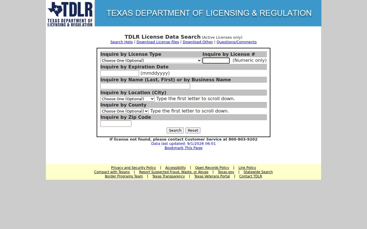
The ZIP filter narrows an active-license query. It does not establish a current household address.
The TexasOnline Professional Profiling search provides a second ZIP-enabled route for participating professions.
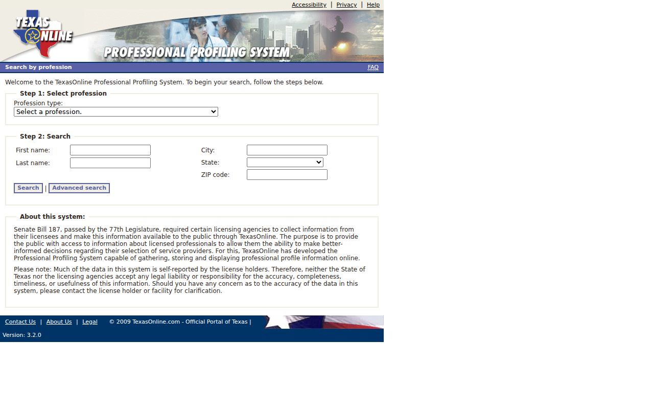
Use the result as professional-record context and confirm details with the specific licensing board when necessary.
Houston ZIP Boundaries and City Limits
ZIP boundaries and Houston city limits solve different problems. The city’s 77099 map shows dashed black city limits and solid red ZIP lines as separate boundaries, with nearby ZIPs visible across that area. The Planning and Development GIS division assigns official city addresses and confirms annexation boundaries. USPS verifies postal delivery. A record search should use the custodian’s key: the parcel’s situs and account for HCAD, legal description for a deed, and the registration address rules for a voter record.
Houston’s 88 super neighborhoods add a civic geography that is also separate from ZIPs, parcels, precincts, and city limits. The Houston Super Neighborhood Directory gives an activity status, number, and city liaison for each area, not private membership names. Use it to understand a neighborhood label after the address itself is verified.
The official annexation history map runs from 1836 through 2023. It can help explain why an older deed, directory, or plat carries a different municipal context from a current mailing label. General-purpose annexation brings property into the city for city taxes and services, while limited-purpose annexation has a different arrangement. Check the city boundary, postal form, parcel record, and historic description separately when researching a Houston-area address across time.
- ZIP vs. ZIP+4
- A five-digit postal area can be refined by four added digits for a more specific delivery segment.
- PO-box ZIP
- A ZIP used for post-office boxes, which should not be treated as a physical street location.
- Unique ZIP
- A ZIP assigned to a single institution or organization rather than a normal geographic delivery area.
- Carrier route
- A postal delivery grouping within an area, not a city boundary or a resident roll.
Houston ZIP Neighborhood Context
Neighborhood names can help interpret a postal result, but they do not redraw a ZIP boundary. The City of Houston Super Neighborhood program lists 88 areas with a number, activity status, and Mayor’s Assistance Office liaison. Downtown, Greater Heights, Greater Third Ward, Midtown, Near Northside, Spring Branch groups, Sunnyside, and Westbury are examples of civic areas that cross a different set of geographic lines than a postal delivery route.
Use the super-neighborhood map or directory after verifying the address, not as a source for a private member list. The city program provides community-organization context and a liaison route. It does not establish parcel ownership, household membership, or a person’s current location. For a ZIP search, it is an extra geography layer that can explain why an address, neighborhood label, and postal city do not all read the same way.
Houston ZIP Evidence Limits
A ZIP result does not confirm that any named person lives at an address, and a Houston postal city does not prove that a location is incorporated into Houston. A parcel owner may receive tax mail elsewhere. A deed party may not have lived at the parcel. Voter data has protected fields and special protections for eligible people, including Address Confidentiality Program participants. Read every source within its limits.
Texas Address Confidentiality Program participants can use a substitute mailing address and mail forwarding. Texas also protects sensitive voter identifiers and provides statutory address protections for eligible people. Those limits are deliberate. If an expected result is absent, verify the property or record through the authorized custodian rather than trying to reconstruct a private address from unrelated public sources.
Use ZIP records carefully. Keep searches tied to a lawful personal purpose such as family history, estate research, civic review, or correcting a public record. Do not use address information to stalk, harass, or harm anyone.